May 2021: Gunu, Barranbinya, Wongaibon, Barundji, and Wailwan Country
Sometimes a bit of luck lands you in a place at just the right time – and that is certainly true of Two Minute Postcards‘ recent visit to Bourke in far western NSW.
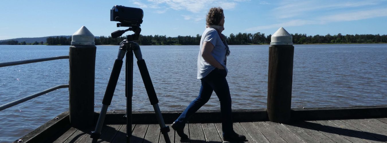
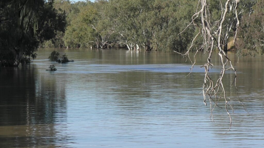
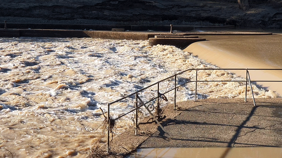
Flooding rains which fell in northern NSW and southern Queensland about three months ago wound their way down the Macintrye River and into the Barwon River before finally reaching the Darling River at Bourke in early May just as I arrived in that wonderful historic town.
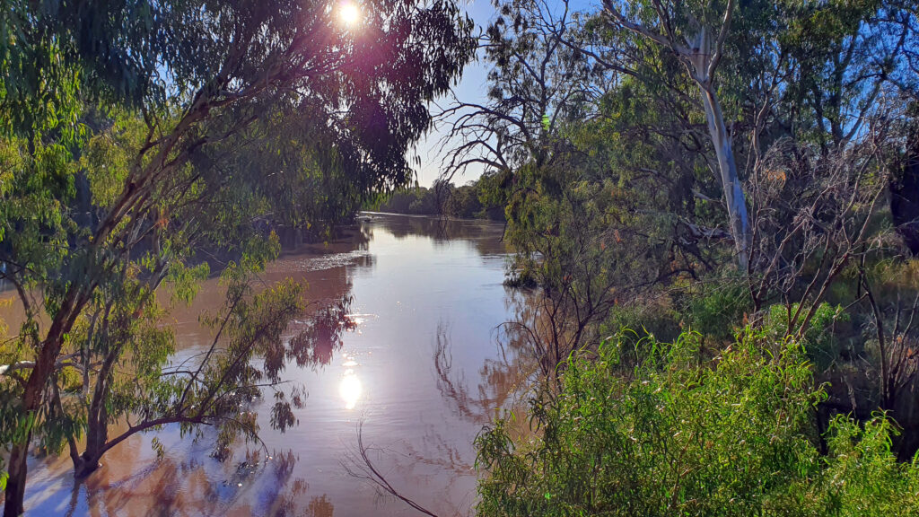
What a sight to see after so many lean, dry years of drought which literally sucked the life out of the Darling River, the town and the surrounding community. I stood on the riverbank and watched the floodwaters swirl past, on toward the Menindee Lakes near Broken Hill (also in desperate need of decent inflows).
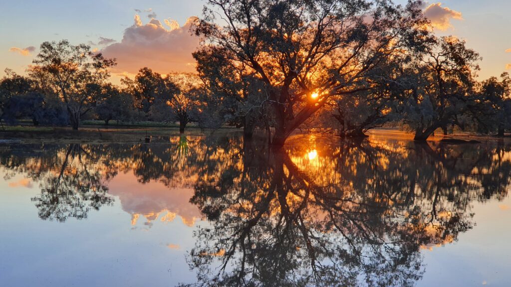
It is reportedly the biggest flow since 2016 and comes on top of reasonable local rainfall which has given the wide, flat, arid plains a green tinge not seen in a while. Billabongs and swamps filled up. Irrigation channels surged with water. Water birds strutted about. The town and the district looked at their best.
What we loved
I got into a conversation with a fellow traveller as I walked around Bourke’s historic streets. She was a regular visitor to the town which she adored. “Surprising” is how she described it – and I agreed. The grandeur of the old buildings is a surprise way out there. They hark back to Bourke’s days as an important river port from which vessels carried wool downstream to the Murray River and onward to the coast for export.
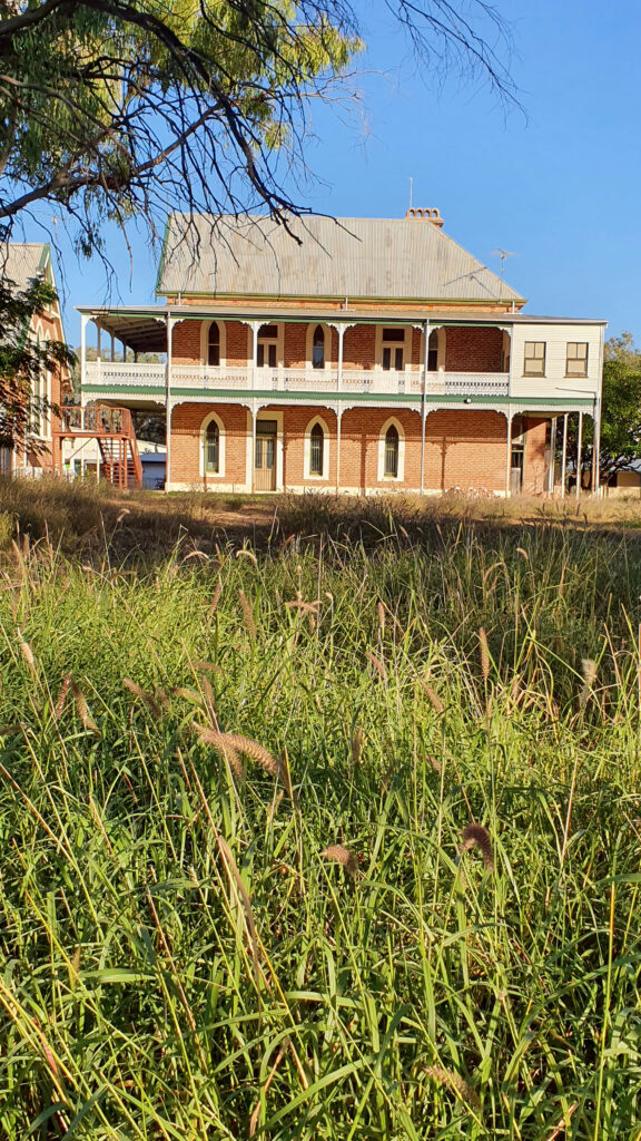
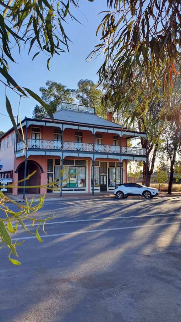
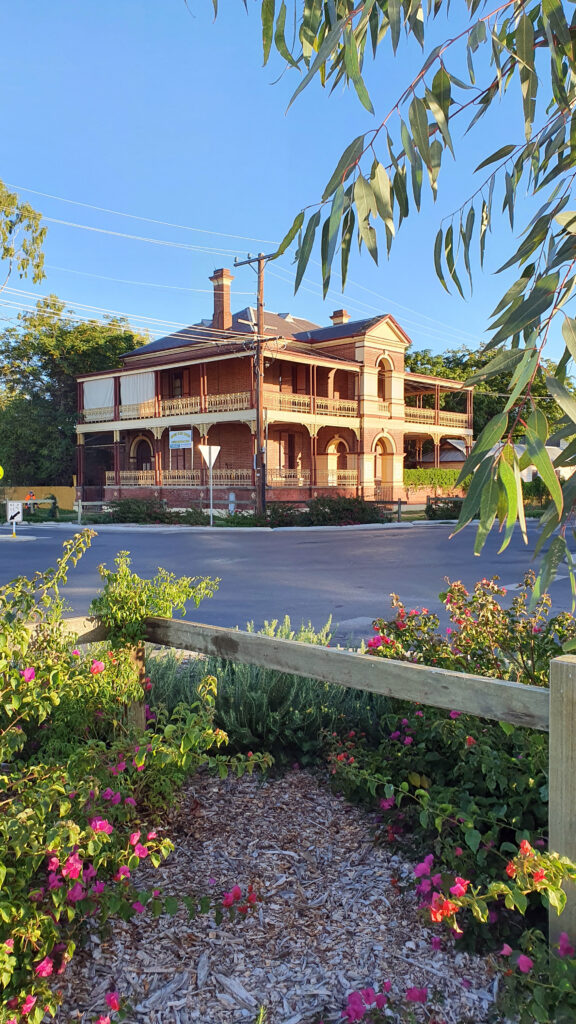
Then there’s the wide streets lined in places by giant fig trees. The riverbanks lined with river red gums. The sheer number and variety of birds. The stark beauty of the flat landscape and its distinctive vegetation.
The “romantic” link to the poetry of Henry Lawson, with drovers and vast historic agricultural properties like Toorale. The ancient associations and stories of the traditional landowners – first nations people – whose links to this country vastly predate the arrival of pastoralists in the 1800s. Bourke NSW is a surprising and intriguing place alright.
What we did
Explore the river
Various Aboriginal tribes lived along the sections of the Darling River and it’s tributaries. The largest language group was (and remains) the Barkindji whose traditional lands stretch from Wentworth almost to Bourke NSW. The Aboriginal name for the river derives from them – Barka. Barkindji literally means the people of the Barka (river).
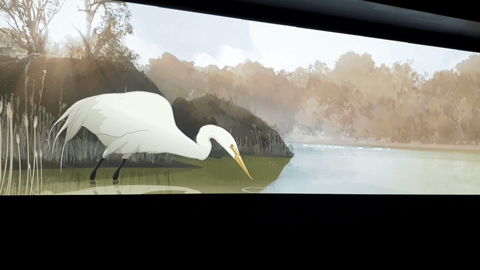
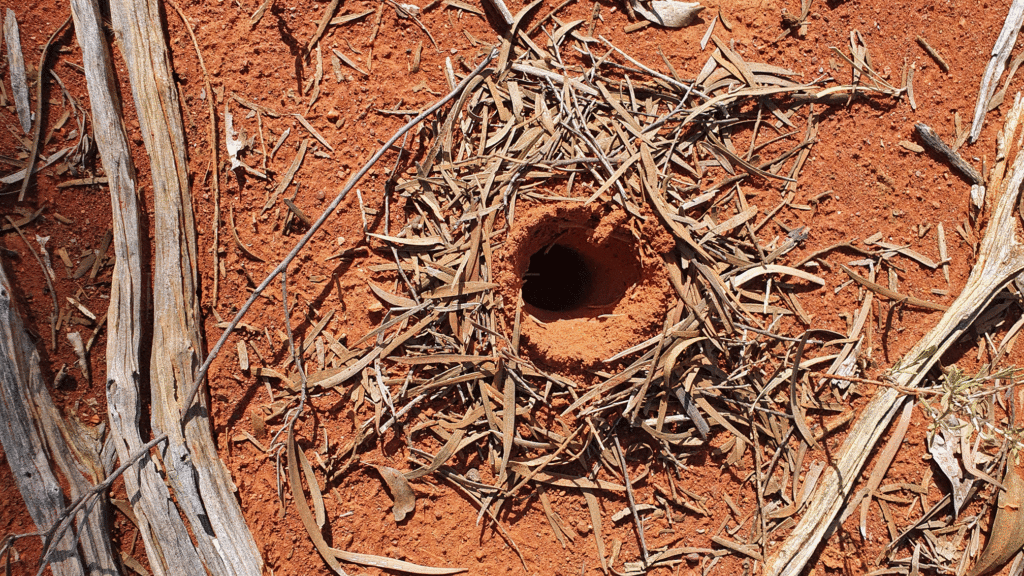
The river, its tributaries, waterholes, and billabongs were essential to the life of Aboriginal people, providing food, water and other essentials. There’s an excellent and quite beautiful animation at the Back ‘o Bourke Exhibition Centre which explores this association – absolutely worth seeing.
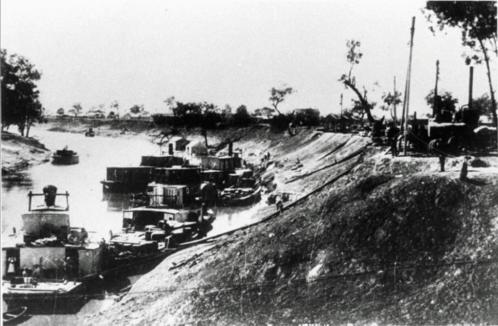
Explorer Charles Sturt turned up in 1828 and stayed long enough to give the river its European name and deem the area unlikely for settlement. Colonial era road builder Sir Thomas Mitchell arrived in 1835 and set up a “fort” which became known as Fort Bourke. But it was not until Captain WR Randall sailed a vessel up the Darling from South Australia that the town of Bourke would hitch its wagon to the ebb and flow of the river. Likewise, ambitious pastoralists set up their vast farms around the rivers and floodplains.
The Wharf and river walk
When Bourke was the largest inland port on the Darling River from around the 1860s, the wharf was a constant hive of activity. The Wharf that stands today at the end of Sturt Street is a replica, but its construction shows how the various river heights were managed – with multiple levels. It’s a good place to view the river before taking a stroll along the short river walk where information signs document the long-gone river trade. The last commercial river boat finished in 1931.
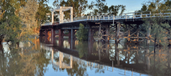
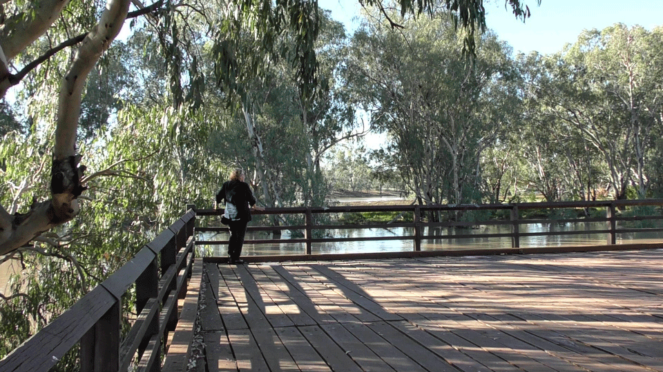
North Bourke Bridge
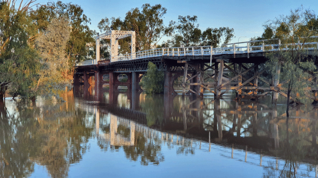
It was brought from England in pieces and shipped up the Darling in sections, to open in May 1883. It is Australia’s oldest movable span bridge and served at the height of the river trade era. The span could lift to allow taller vessels through and presumably allow for the rise and fall of the notoriously fluctuating river (it dried up completely 45 times between 1885 and 1960). You can no longer walk on the bridge, although I am told funding is being sought to repair and restore it for pedestrians in the future. We found a good viewing point in Bogan Street, North Bourke, across the road from Bourke Bridge Inn.
Lock and Weir
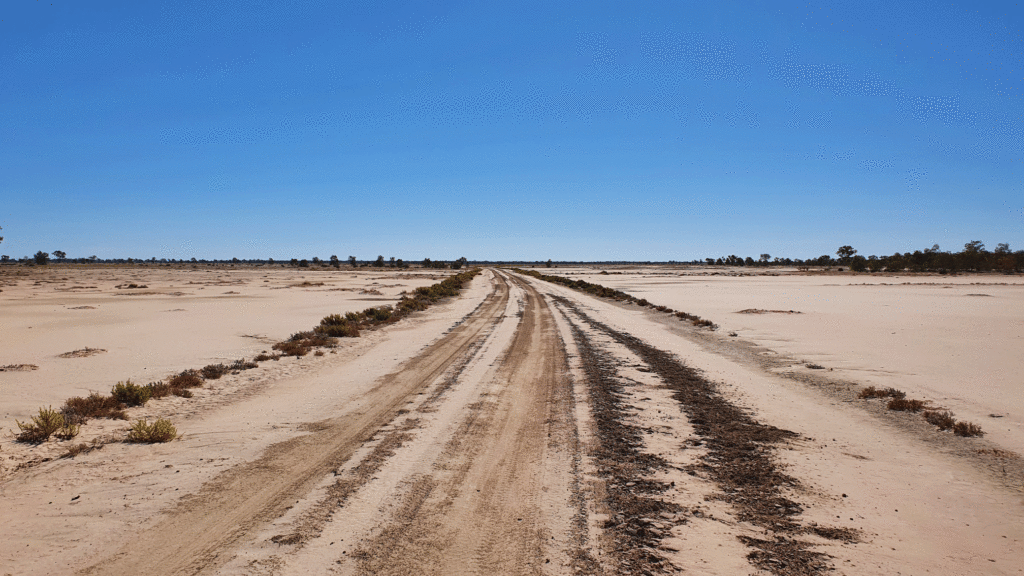
It is worth a drive just out of town to see the historic weir – the only one ever built on the Darling River. You’ll find it by heading out on the road to Cobar, taking a right-hand turn at the now closed Central Australian Hotel (Anson Street). Follow the road out (partly unsealed) until you get to the river. You can’t miss it. Interestingly, the weir was installed to maintain a reasonable water supply for the town. The flatness of the landscape means that the weir, which is only 4m high, backs water up stream for 40km.
PV Jandra
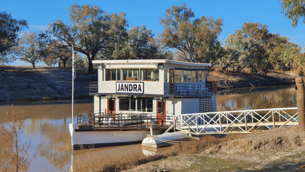
There is no better way to get a sense of the Darling River and its history than from the PV Jandra, a modern-day version of the original steam paddle boat Jandra which travelled the river around the turn of the century. From its decks you can experience the stark beauty of the river and its wildlife and perhaps imagine the days when it was a transport superhighway for Bourke. The vessel makes twice daily voyages when conditions allow, and you can book your ticket at the Back O’ Bourke Information and Exhibition Centre. Our voyage took about an hour.
Historic Buildings
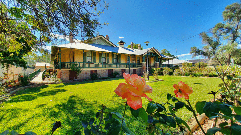
From the 1860s until the river trade stopped in 1931, Bourke NSW enjoyed significant prosperity and was the transport centre for southwest Queensland and western NSW. At its peak, 40,000 bales of wool were shipped down the Darling each year. The historic buildings which remain in the town reflect that wealth and importance. The grand post office, the wonderful courthouse, the graceful old London Bank (and others) give the town a charming historic feel.
The cemetery
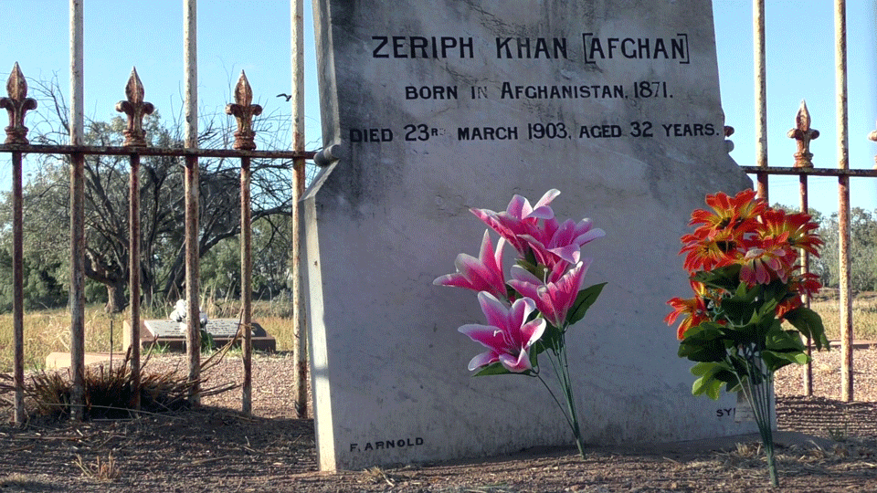
All cemeteries tell stories of life and loss, but Bourke’s cemetery is particularly revealing about the nature and the toughness of life for its earliest residents. Police who died capturing bushrangers, Afghan camel drivers and merchants, children killed tragically in an accident at an annual picnic, the man who died the day after his mum.
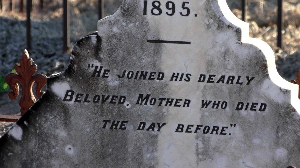
A cemetery guide is available from the the visitor’s centre. You can expect to see epitaphs that chart the precariousness of life – “drowned” “killed by lightning” “murdered” “poisoned” “perished in the bush”. Quite fascinating. Noted eye surgeon Professor Fred Hollows is also buried there.
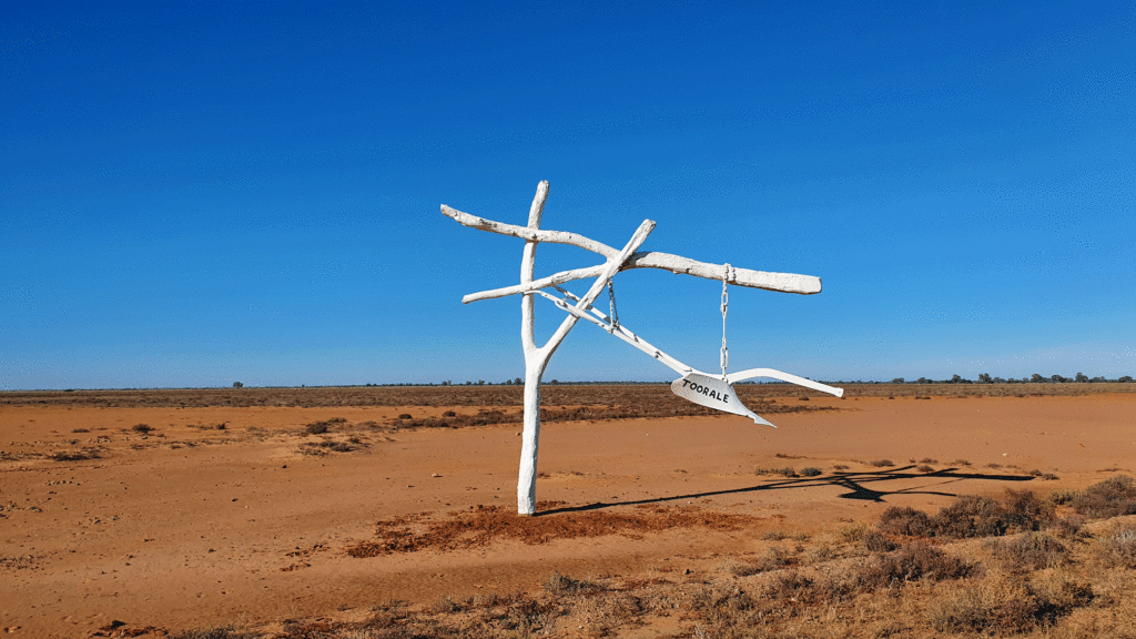
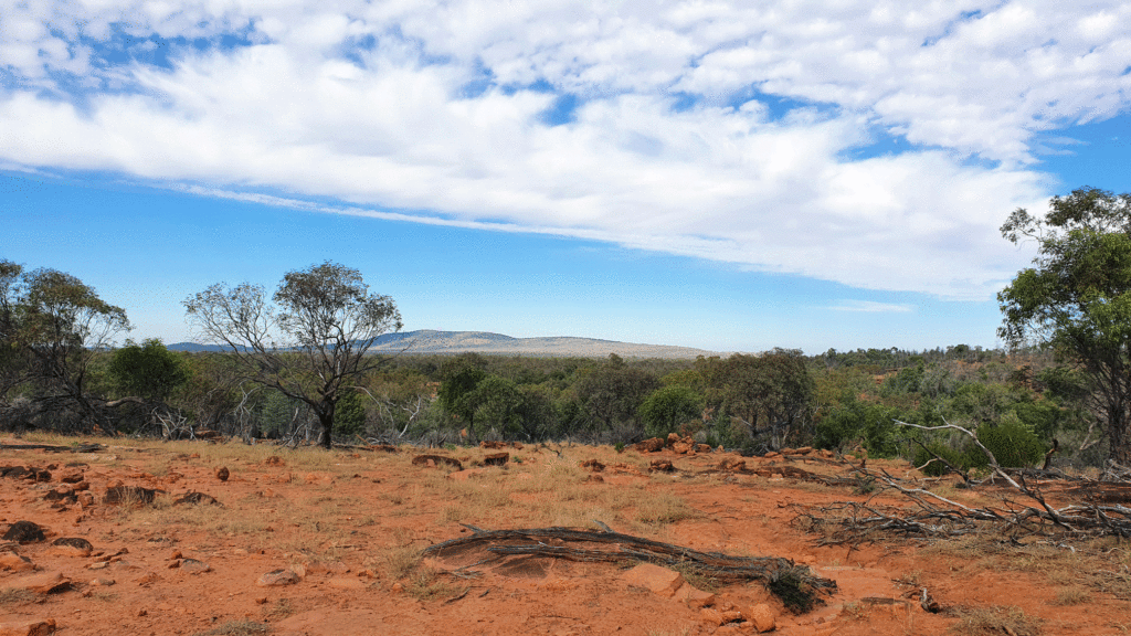
Toorale National Park
Here’s a fantastic side trip to take while in Bourke. The relatively new park is located 80km southwest of Bourke, at the junction of the Darling and Warrego rivers. It’s about an hour’s drive on mostly unsealed roads which require a 4WD. The roads were in good condition on the day of my visit but can be impassable after rain. Ring the NPWS office in Bourke to check road conditions before you set off.
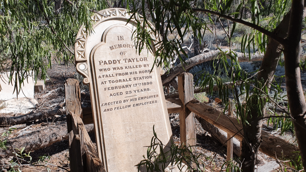
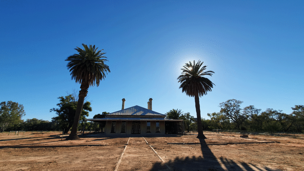
Highlights of the visit were the historic homestead precinct, watching birds around Dick’s Dam, the Warrego Floodplain Drive, and the spectacular views from the top of Mt Talowla. Talowla is little more than a rocky hill, but when the landscape is as flat as it is on Toorale, it makes for spectacular 360-degree vistas. Darling River Drive and its picnic areas were closed on the day due to flooding. Not far from the homestead, on a little known track is an historic burial site with at least two graves, whose poignant epitaphs emphasise the difficulties and dangers of life on an isolated station.
Toorale was a western district pastoral station established between the 1850s and the 1860s with the gradual merging of numerous selections along the southern end of the Warrego River and on the adjoining northern shores of the Darling River. Toorale (in the early days pronounced ‘Tooralie’) was the head station of the property, which by 1881 covered more than 566,000 hectares (1.4 million acres). During the 1880s it was part of the largest sheep station in the world.
The Federal and NSW governments purchased the then 91,000-hectare property in 2008 at what turned out to be the end of the long drought that had persisted since 2003. The property was acquired to secure water for the environment of the Murray Darling Basin through the Water for the Future Program and to incorporate under represented bioregions into the National Reserve System.
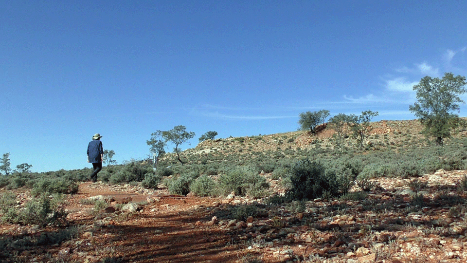
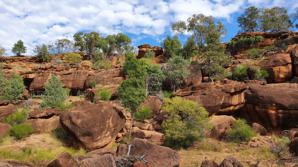
Gundabooka National Park
Gundabooka National Park is located between Bourke and Cobar. The roads in are gravel and heavily corrugated in places. The park contains impressive natural features, significant Aboriginal sites, historic features and habitat for threatened plants and animals. The park also contains Mount Gunderbooka, which is the outstanding geological feature of the Bourke area – a dramatic example of an isolated syncline that has formed as a result of tectonic movements over many millions of years.
Physical evidence of Aboriginal use of the area survives in the form of art sites, stone quarries, open camp sites and scarred trees. The art site open to the public is Mulgowan Aboriginal heritage site which was our first stop. It’s an easy 1.4km (return) walk from the carpark to the rock art site on Mulareeya Creek. We had a couple of young kids in tow who managed it easily.
There are several longer walks (two to three hours) which were beyond the range of our youngsters, but we’ll get back for those another time.
Where we stayed
We stayed at the historic Riverside Motel which is the only motel to front the Darling River. The motel complex was created from the 1875 Telegraph Hotel and the surrounding original riverboat township. The rooms were clean and comfortable and within easy walk of the main street, pubs, cafes and restuarants. It was a lovely quiet place to stay.